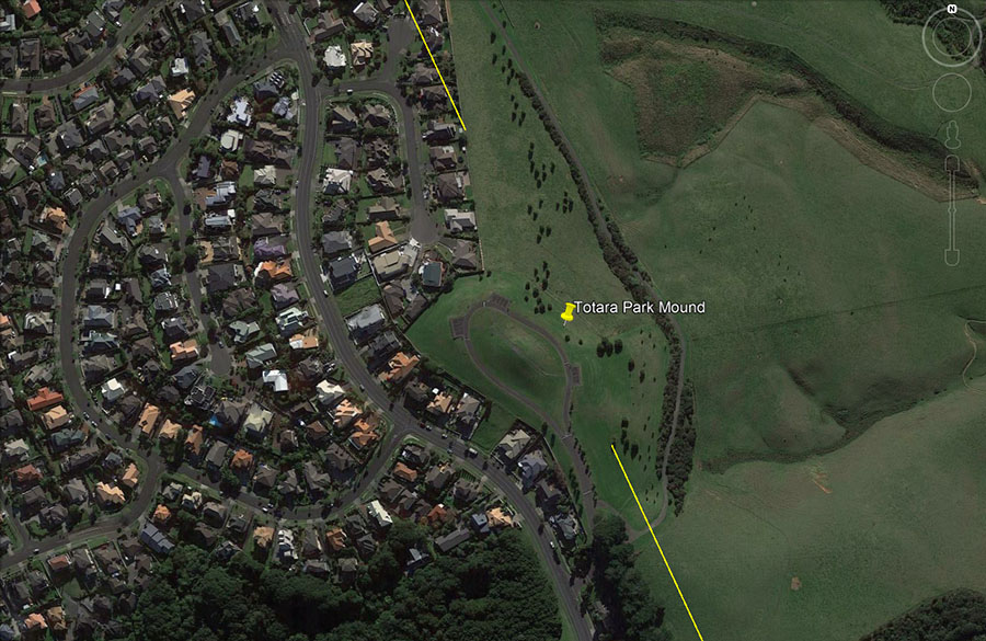
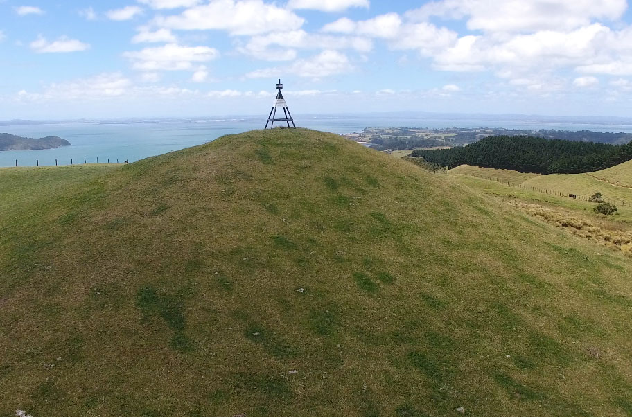
The line from the Mount Wellington trig proceeds to an ancient mound position at Totara Park, Manukau City, before extending to a major resolving area and junction on Mount William.
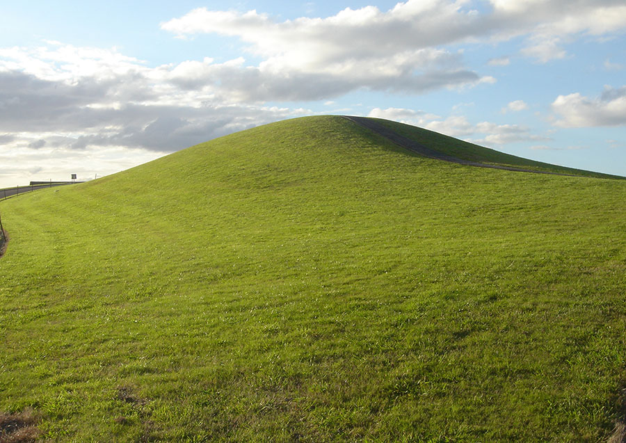
After locating other component parts of the North Island dissecting line, it was determined that there should be a marker in the high elevation terrain near Manukau City. Having back-calculated the approximate coordinates where the marker should be, this researcher drove to the region and happened upon this mound situated on the line.

From the elevated mound position, a long hill-range to the west provided excellent fix positions for the summer solstice to the winter solstice sunsets and the equinoxes in between.
Very conveniently, from the summit of the mound the northern & southern sides of the Manukau harbour entrance appear to touch on a perfect azimuth angle of 260-degrees. For anyone using the 5000-year old (+) 360-degree angle system (attributed to the Sumerians, but obviously much older), this would mean that the base of the “V” at the converging headlands would be perfect for setting a compass disc on 260-degrees and then reading the correct angle positions for all other targets around the horizon.
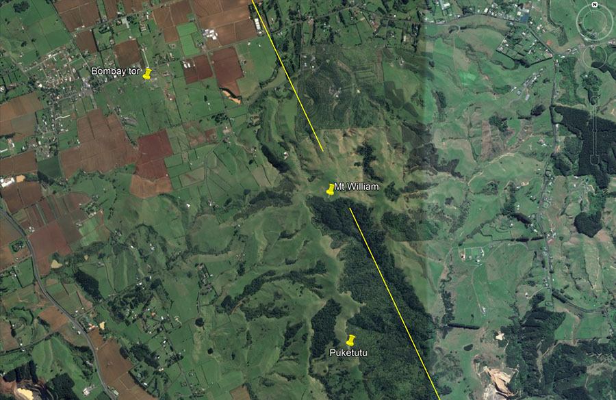
Beyond Totara Park mound is the wide expanse of Mt. William, which looms up at the southern reaches of the Auckland Isthmus. It is a veritable resolving point for incoming alignments from many directions around 360-degrees of vista and incorporates a large number of ancient sighting pits, oriented towards particular far-flung targets.
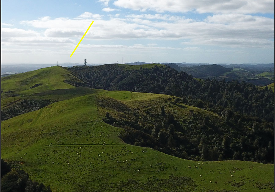
Mount William with its communication towers and trig is seen in the centre skyline. The yellow arrow points at the vague outline of Rangitoto Volcanic Island, 30-miles NNW.
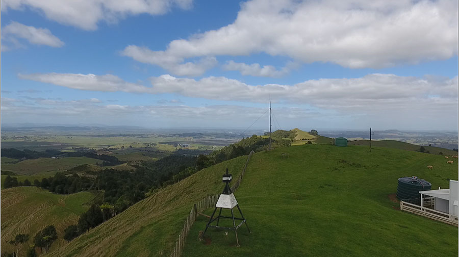
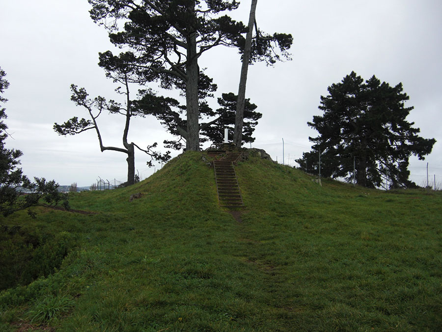
Atop Mt. William at the eastern side of the hill is a modern-day trig tower (no. A8UM) sitting on an ancient trig mound. In the background of this photo, slightly right of centre, is Puketutu hill, the top of which has been laboriously worked to form a symmetrical cone that can be seen for many miles. It is, at present, the largest ancient tor mound in New Zealand known to this researcher. Yet another mound is found atop Mount William to the NW side of the hill.
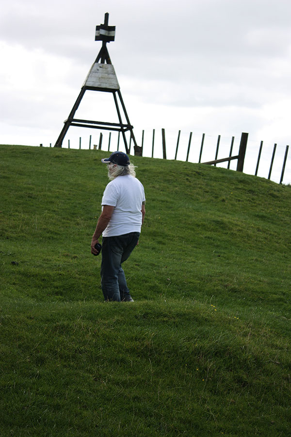
On the side of the trig mound in the foreground and easy to see in this photo are sighting pits, for observers to sit in when making angle fixes on mountain ranges or other targets to the east & west. The fact that sighting pits are dug into the mound attests to the antiquity of the hump structure and that it was purpose-built long before colonial times.
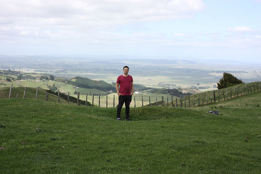
The author standing in one of the many sighting pits identified between Mt. William and Puketutu tor mound to the south This wide complex of ancient trigs and observation pits, oriented towards every direction through 360-degrees of vista, was a major resolving station for alignments across the Auckland Isthmus from the 36+ high volcanic cones or other positions.
Another of the dozens of sighting pits found at Mt. William and nearby Puketutu tor mound for orientation onto distant ranges or locations. The more important of these are double pits side-by-side with a pronounced hump separating them. The elongated hump indicates the alignment direction and the targeted outlier on the horizon.
Our establishment archaeologists call these enigmatic depressions “kumara pits” for storing sweet potatoes. However, the pits are most-oft found in isolated, totally inconvenient places up the sides of hills and far away from known settlements. The areas in question are, for the most part, indefensible and were never fortress locations where defenders could ward off invading armies or wait-out a long siege with sustaining supplies.
Our archaeologists need to complete a comprehensive course in ancient surveying techniques before inflicting us with their implausible explanations. Latter-era Maori warriors might well have used a few (very few) of these pits for storing kumara or for sentinel positions to observe the approach of an enemy, but that’s not the purpose the ancient Patu-paiarehe originally dug them for.
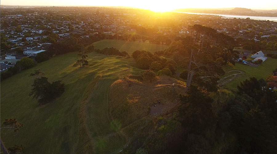
Yet another ancient trig mound crowned with a modern tower. It has two large sighting pits, one of which can be partially detected in this photo (top left just below the mound summit). The presence of sighting pits attests to the antiquity of this mound as a purpose-built astronomer-surveyor’s position. It also doubled as the summer solstice sunset position from Pidgeon Mountain in Pakuranga, Auckland Isthmus (22-miles distant), and an interim hill (Hamlin’s Hill or Mutukaroa) 17.5-miles distant) with a sighting pit perfectly on an alignment to this mound at the southern headland of Manukau Heads.
From the Pigeon Mountain mound the summer solstice sunset is onto the South Manukau Heads trig mound. Like all of the 36+ volcanic cones of Auckland, Pigeon mountain was carved and shaped by the ancient Patu-paiarehe people. In this photo Mt. Wellington (Maungarei) is seen on the skyline at the upper right.
Pigeon Mountain mound, with a modern trig on its crown. To the left is seen the edge of a volcanic crater and lava cave.
Like the ancient, pre-Roman Celts the Patu-paiarehe people set up solar paths (based upon the solstices and equinoxes) for travelers crossing New Zealand from coast-to-coast. We are looking at a component part of one such trail (or waymark station) here at Pigeon Mountain. By knowing the sun’s rise and set angles at the equinoxes and solstices, travelers could let the sun-god guide them to a destination, content in the knowledge that there were rest stops and provisions available at communities along the sun-line trail. Traversals of the country could occur with reasonable accuracy at any time during the year, as solstice or equinox sun-drift adjustments could be calculated into the mid-season direction of travel.
Like the ancient Celts traveling on the Herculean Way sun-paths, a voyage would begin from a particular, known community or starting point relative to that journey, before striking-out to the desired destination. In New Zealand, beyond the long stretches of coastline beach highways, the ancient Patu-paiarehe built a vast network of inland, cross-county walking tracks.
But we digress. Let us return to the Mount William array of purpose built surveying positions: