THE NORTH ISLAND SURVEYOR’S BASELINE.
It must have taken decades, at least, to plan the long overland dissection alignments of both the North & South Islands of New Zealand, using the loftiest points possible that would comply with a singular straight line of sight. In the far more temperate North Island at least, at intervals along the chosen lines, the surveyor-astronomers were obliged to build mounds adorned with obelisks, as well as other structures such as sighting pits. The pits themselves would often circumnavigate the main-trunk-line, high trig position and orientate towards high mountains, hills or off-shore islands. From the sighting-pit secondary surveying stations degree angle fixes could be made on the outlier targets and, through trigonometric calculations, the country could be mapped.
Likewise, surveyor-mathematicians living towards the coastal regions could look inland to component parts of the central dissecting line to do to more localised mapping calculations. They would know that the main trunk line of mountains or viewable trigs sat at a singular, known angle in relation to each other. The southern running alignment from the North Island to Mount Aoraki ran SSW at 220.16-degrees, whereas the northern alignment from Northland to Taupo ran SSE at 155.34-degrees. Detectable in the North Island, over long distances, there were sometimes small deviations of perhaps a quarter of a degree back & forth off-line, undoubtedly due to the limitations of human vision or the impossibility of moving hilltops to always be perfectly on-line.
It seems obligatory that the ancient South Island, East Coast resident surveyors, observing, say from the Port Hills of Christchurch, used an east-side, separate alignment angle down the backbone ridge of the Southern Alps that centred on primary Southern Alps’ targets viewable from the east.
Our identification of the ancient trigs on the North Island main-trunk-line is far from complete, but sufficient remains to ascertain the existence of the alignment.
Here’s a section of it:
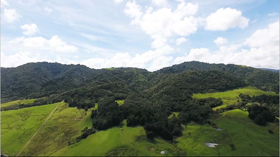
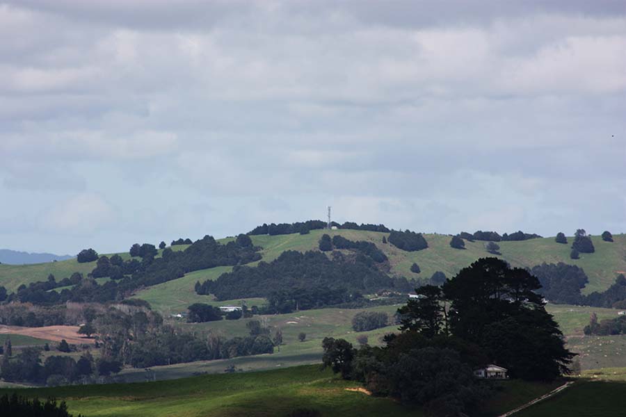
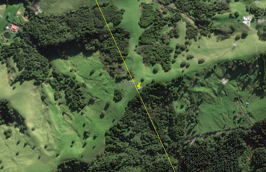
In Northland at Maungatoroto a high range of hills looms up over a tidal estuary. The location was perfect for access to the sea, foraging for mollusks, crustaceans, fish or water-birds in the tidal estuary, as well as vast areas of good arable land for cultivation. The nearby high country afforded spectacular views over vast distances through 360-degrees of vista. By back-calculating the positions of identifiable man-made structures of the dissecting alignment further to the south it was possible to ascertain that the faintly visible tower position atop the central hump of this photo was the former crossover location of the main-trunk-line mapping alignment.
This is unsurprising, as modern-day surveyors or telecommunications engineers often site their trigs or towers on the same high ground that ancient surveyors used for their mound and obelisk trigs.
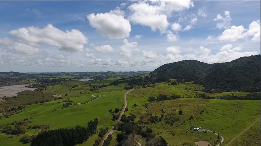
There is high ground at the western base of the range that affords magnificent views to the west, north or south and ancient sighting pits, for viewing targets at far-flung locations, are still in evidence there.
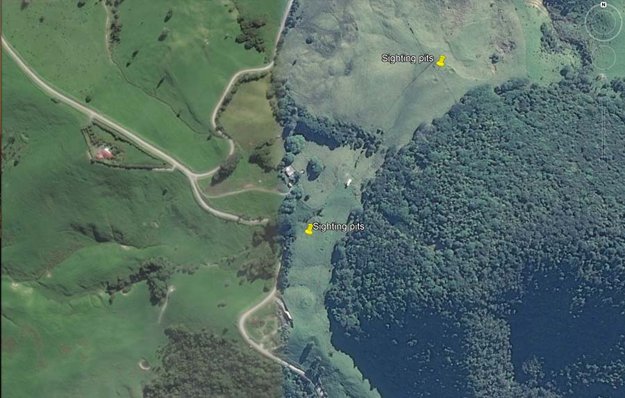
This Google Earth photo shows ancient sighting pits orientated for surveying angle views to targets northwards, west and southwards.
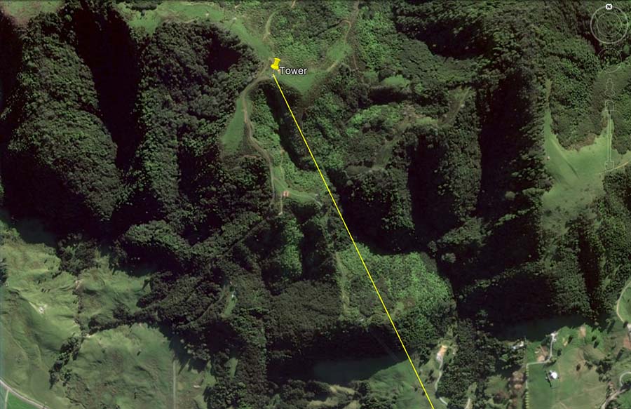
Although the component structures of this alignment situated further north have not been fully located, it suffices to identify structures that range southwards through the Auckland Isthmus and onwards towards Lake Taupo. The line from the Maungatoroto high point, where a modern tower now sits, extends to the next high point just beyond Kaiwaka township.
This is a magnified view of the next southwards hilltop on this alignment. Again, because of its lofty status it was chosen as a modern-day communications site and has a transmitter plonked on its summit.
![]()
The modern transmitter atop an ancient hill-top trig.