ANCIENT STANDING STONE COMPLEX AT TAUPO, NEW ZEALAND
A SOUTHERN HEMISPHERE OPEN-AIR UNIVERSITY
It is becoming increasingly recognised around the world that anciently-built, structural anomalies exist for which our academics and institutions of higher learning have no plausible explanation … and thus ignore.
Not only do our modern-day experts deny the fact that ancient, great civilisations had high technology and well-developed sciences at various epochs, but they are also totally blind when it comes to seeing vividly-conspicuous structures “in plain sight” … if their education, illustrious peers or political agendas discount/forbid such structures to exist.
Under academia’s dogmatic isolationism religion, the pervading rule is that ancient peoples were stuck long-term within geographical boundaries and could not move beyond such things as oceans or mountain chain barriers and thus had to develop culturally in isolation, with few or no outside cultural influences entering in. Under this concept it would be unheard of to suggest that ancient people from the Middle East, Continental Europe or the British Isles could possibly find New Zealand at the opposite end of the globe.
However, another, albeit much-maligned, school of thought is diffusionism, which claims that the oceans of the world were highways, not barriers, and that cultures from all over the globe have been inter-relating and influencing each other from remote antiquity.
It is astounding that archaeologists can wander through, around or over particular ancient, purpose-built and utterly anomalous sites, but never notice anything unusual or out-of-place in the lay-out, sufficient to initiate a scientific investigation. If their education dictates that something can’t possibly be there in the landscape, then it’s emphatically not there in the landscape … end of story!
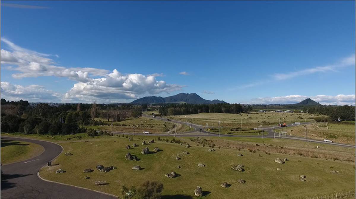
The last remnants of a glaringly anomalous, out-of-time-and-place site, comparable to “the elephant in the room scenario”, is found at Wharewaka, Taupo in New Zealand’s central volcanic plateau.
Giant obelisks, many standing upright and others recumbent, cover this hillock mound at Wharewaka, Taupo. From the centre hubstone (the largest obelisk of the site) the winter solstice sunrise is out of the high crater of extinct volcano, Mount Tauhara, seen in the centre of the picture. From the southern base of smaller Mount Maunganamu (right) “first glint” of the equinoctial sunrise occurs and the sun then climbs up the mountainside to launch itself into the sky.
The most basic feature that should have gained the undivided attention of archaeologists is the fact that many of the obelisks are in an unnatural standing position. If these were boulders spewed-forth from a violently erupting volcano, then they would neither look so regularly shark’s-fin shaped nor would they sit so perfectly upright. The visual evidence shows that the giant boulders have been carefully purpose-placed into individual positions after being chosen as markers due to their unique, sought-after shape.
Despite the visual evidence of a dynamic, sprawling, standing-stone archaeological site, a Taupo District Council publication states:
‘No archaeological sites are recorded within the lakeshore reserves.’ This statement encompasses the Wharewaka Reserve and its satellite parks, dotted with standing and fallen obelisks, cairns and laboriously built mounds.
Archaeologist, Perry Fletcher wrote in October 2003:
Conclusion.
In addition to my inspection in the field, from my search of site records, land transactions and public record, there is nothing exposed or suspected of any historic place within the area for the proposed subdivision to record, set aside, or protect by way of any evidence of occupation, (both European and pre-European) required by the relevant sections of the RMA and NZ Historic Places Act.
Thus, due to ineptitude, large sections of a world-class, standing obelisk site that was almost on a par with Avebury Henge in Britain and a multitude of other megalithic sites across Continental Europe, got ploughed under by bulldozer blades and eradicated forever.
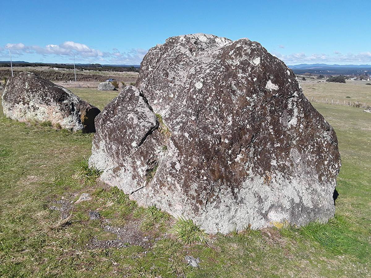
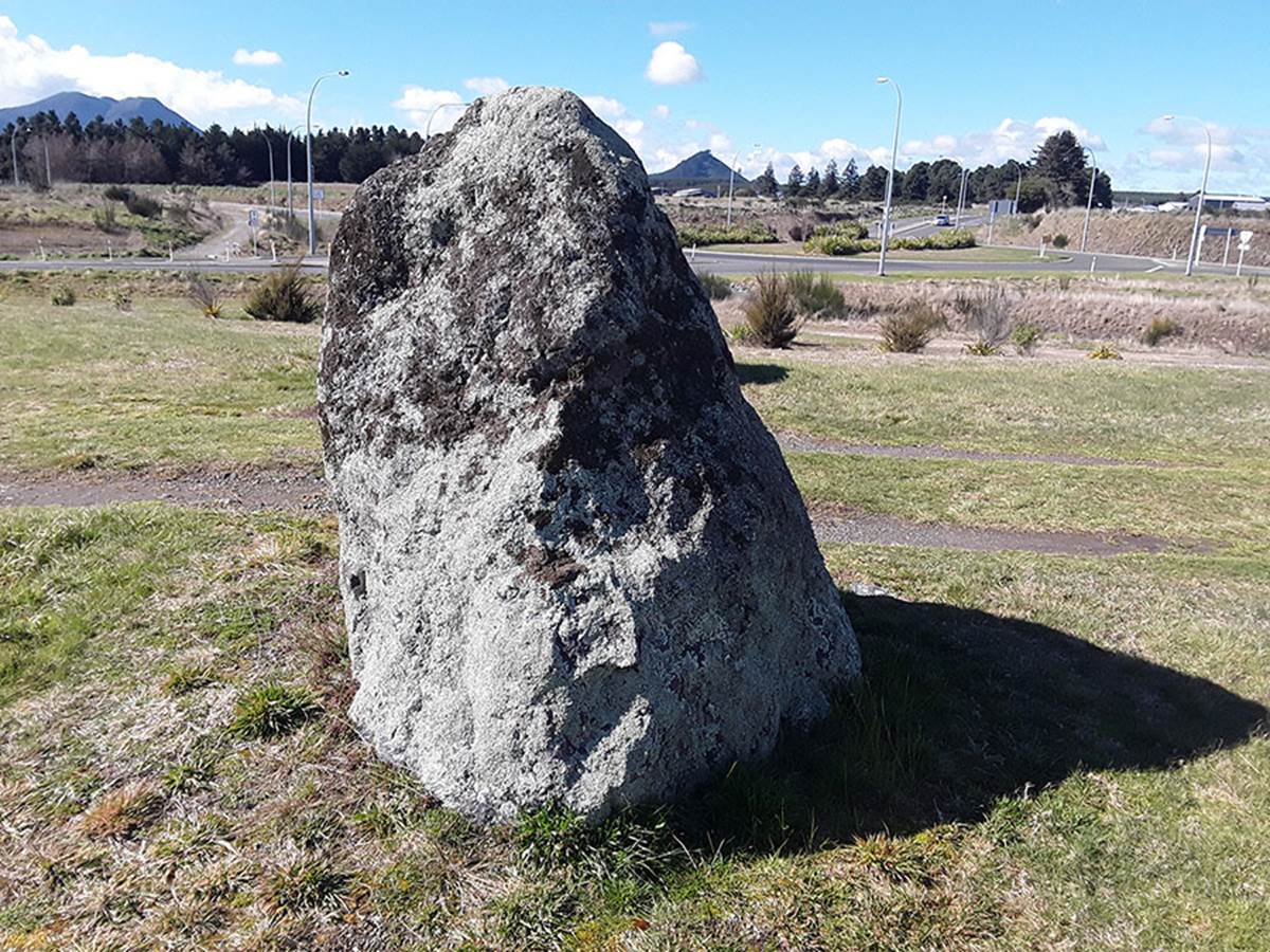
The surviving giant hubstone at the centre of the site, (standing 7-8 feet high) from which all surrounding obelisks are purpose-placed at coded distances and angles. It sits unnaturally upright, whereas others in the background lie recumbent. The hubstone has the worn remnants of a bullaun bowl carved into its summit section.
From this position both the winter solstice and equinox sunrises can be read with accuracy, using the positions of two horizon mountains as outer-markers for these significant, annual solar events. There are still a few batches of obelisks placed much further afield of this central position to give fixes on true north, due east as well as other distance & angle codes of position. The rest have been allowed to be erased from history, due to ignorant people rubber-stamping permission for them to be destroyed.
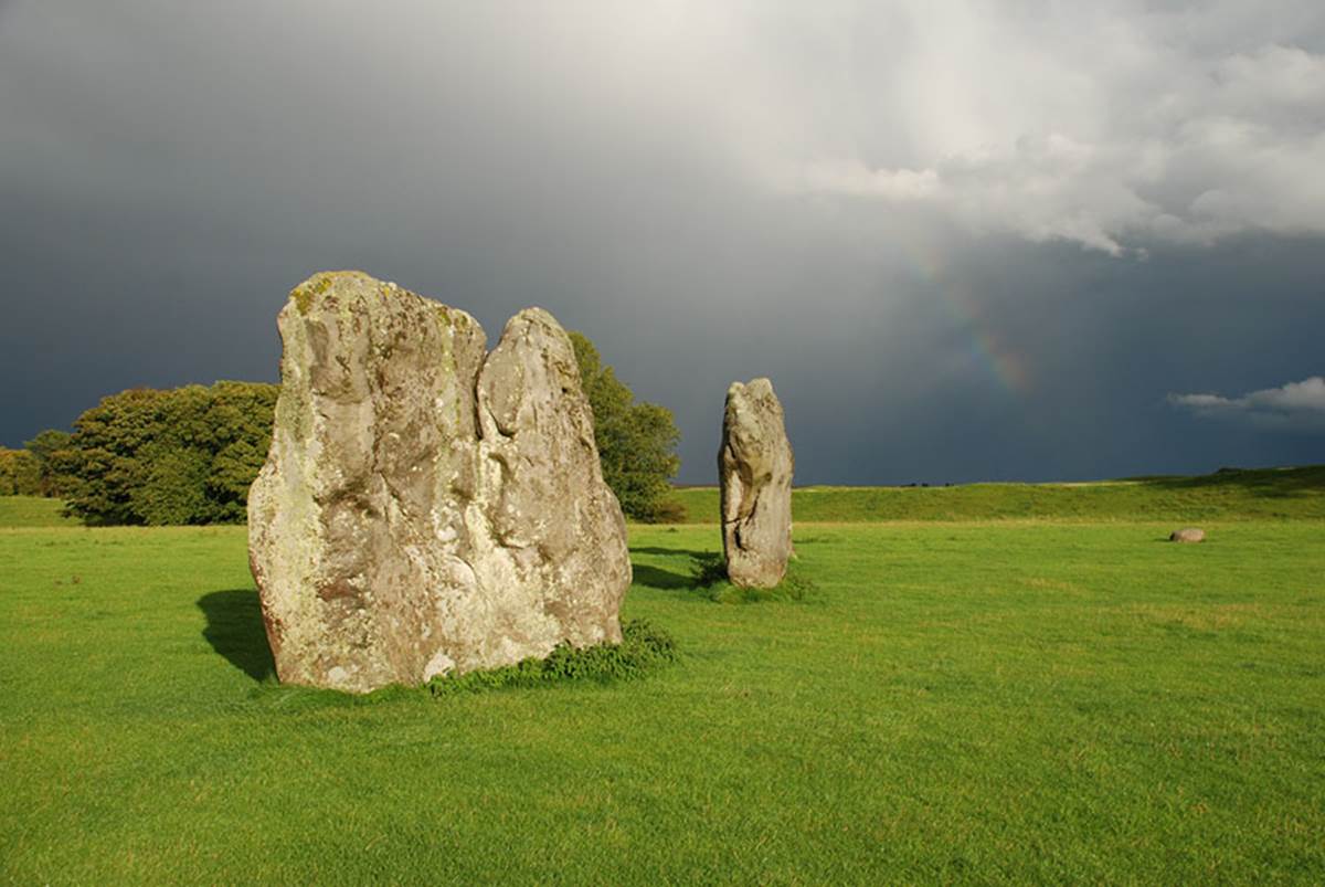
By way of comparison, here’s a picture of a couple of obelisks at Avebury Henge, Wiltshire, Southern England. It’s doubtful that anyone with an ounce of common sense and analytical ability could conclude that these stones occurred naturally in this upright position. It’s glaringly obvious, looking over the totality of the site, that the huge obelisks have been laboriously hauled in and purpose-placed, standing erect, in designated positions away from a central hubstone.

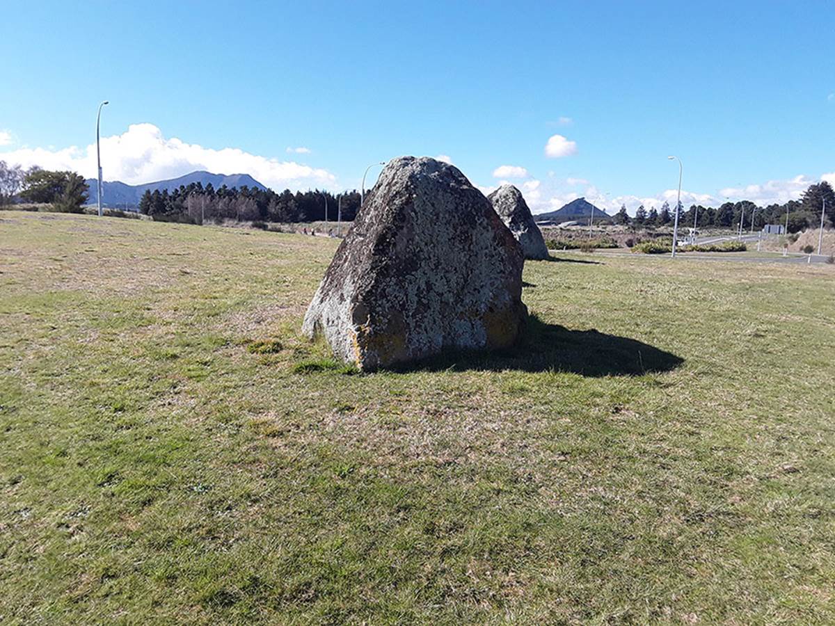
From the hubstone at the Taupo, New Zealand site, the top of which can be seen in the lower part of the picture, the winter solstice sun emerges from the crater of extinct/dormant volcano, Mount Tauhara. This annual phenomenon provides a perfect calendar fix-date for the winter solstice and, from this, all other days in the 365.25-day annual count can be determined, with further solar checks at the equinoxes and summer solstice.
The carving of bullaun bowls into boulders is a very ancient cultural expression of megalithic Ireland especially, as elsewhere across Britain & Continental Europe, for blessing & cursing altars at waymark stations or holy wells. Several of the obelisks situated around Wharewaka reserve have bullauns carved into them, whereas others are incised with cross-hatching lines, once thought to be a cultural idiosyncrasy unique to Megalithic Britain.
Another of the perfectly upright, shark’s-fin shaped boulders, with Mt Tauhara (left) and Mt Maunganamu (right) looming above the horizon in the background.
And yet another of the many unnaturally erect standing stones that have the elongated shark’s-fin shape. It is worthy to note that these giant, shaped stones are commonly found at other “standing stone” circles (arrays) elsewhere in New Zealand, like at Maunganui Bluff, Northland, or Koru PA, Taranaki.
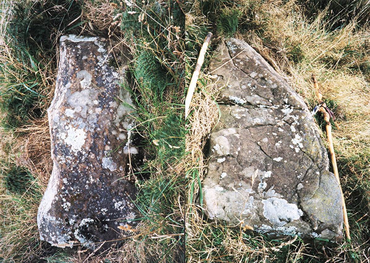
Here are two of the many “shark’s-fin” shaped boulders that were once component stones at an ancient standing stone circle (array) located at Maunganui Bluff, Northland, New Zealand. They served the same distance & angle function (away from a hubstone), for encoding special scientific numbers, as the Taupo site or the many similar megalithic sites of ancient Europe, etc.
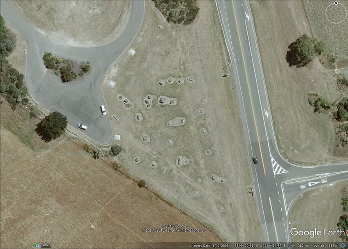
The layout of obelisks for the immediate, central site is seen in this 1/11/2008 Google Earth image. Although this area of the site is still intact, a new bypass road to the east and new subdivision to the north have eradicated many of the more distant marker obelisks that once sat further afield. The coordinates reading in the photo relate to the position of the hubstone.