SECTION 3.
DISTANT SITES – for orienteering exercises such that initiates could learn overland navigation and positional plotting.
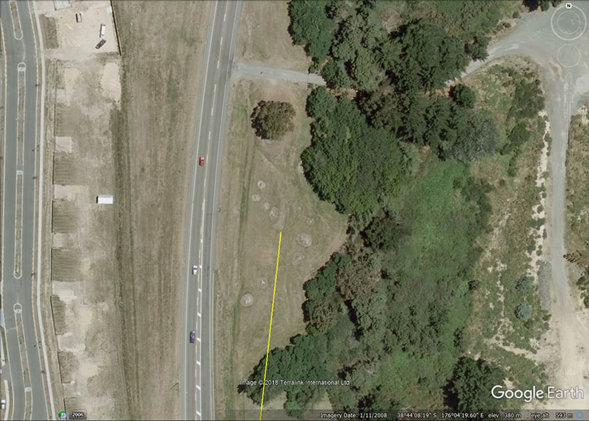
The Google Earth image of site 2 which, thankfully has survived on the eastern side of the highway. The western side is now the large, sprawling Wharewaka subdivision and the stone positions on that side were destroyed by bulldozers or plundered for landscaping features (barrier fences & ornamental objects in park-reserves). The coordinates of site 2 are seen at the bottom of the Google Earth picture.
By the time this year 2008 image was taken, substantial excavations, road-building and landscaping had taken place to create the new Wharewaka subdivision and important obelisk positions had been cleared to the western side of the road.
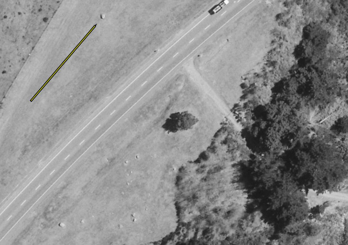
A topographical photo taken in September 1999 shows a giant obelisk situated across the highway. Its immense size indicates that it was of great importance.
SITE 2 POSITION 1.
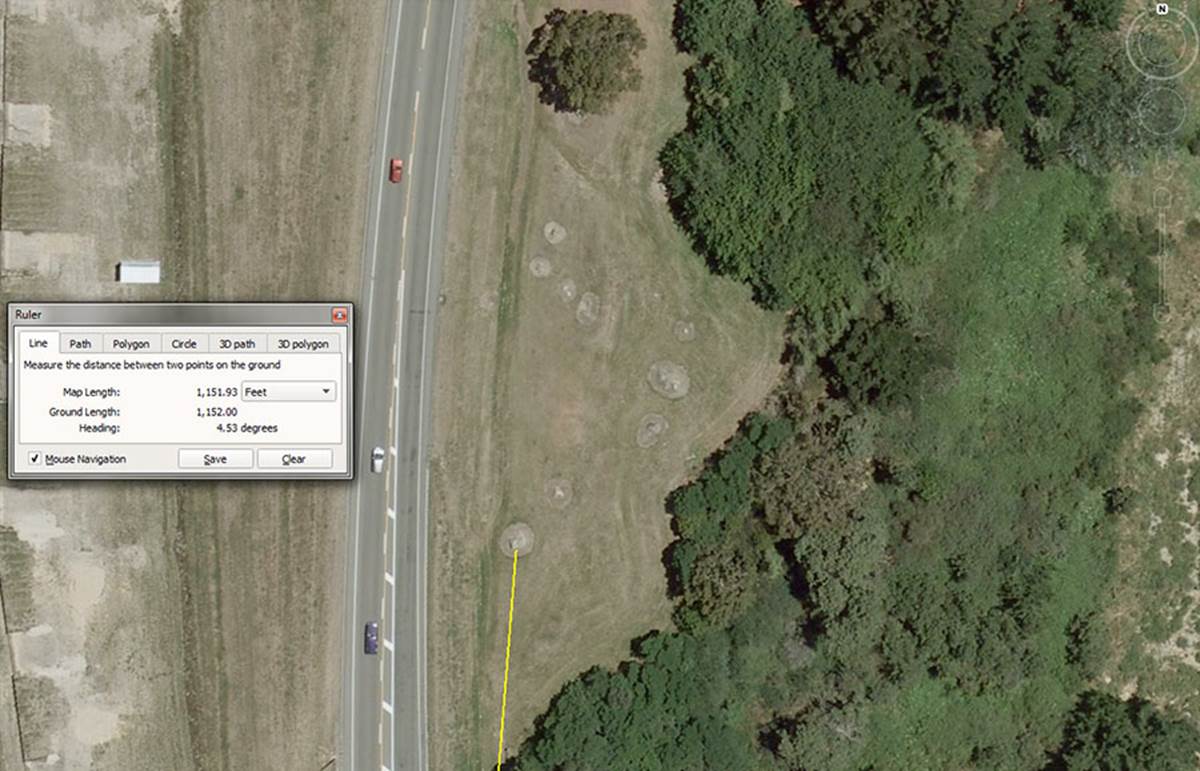
This recumbent obelisk sits 1152-feet from the hubstone on a coded angle of 4.536-degrees.
The obelisk at the bottom left sits 1152-feet from the hubstone at an angle of 4.536-degrees.
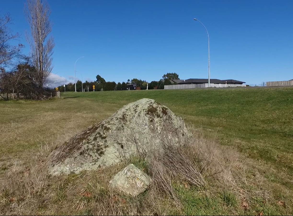
The shark’s-fin shaped obelisk now lies with its top pointing eastwards. One of two chock boulders that formerly helped to hold it upright now lies to the side.
SITE 2 –POSITION 2.
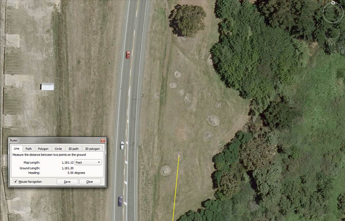
This outer-marker boulder sits 1181.25-feet from the hubstone at an angle of 5.5-degrees.
The 1181.25 value is lunar coding and 118,125-days would equate to 4 lunar months of 29.53125-days (29 & 17/32nds) ... with an accuracy of under 1-minute in time. Incidently, the Khafre Pyramid of Egypt is 15/16ths the length of the Great Pyramid or 708.75-feet long. This length is 6 X 118.125-feet.
Likewise, the Khafre Pyramid was built as two back-to-back 3-4-5 triangles. Half the base length is 3 X 118.125-feet; the designed vertical height is 4 X 118.125-feet and the sloping face is 590.625-feet (5 X 118.125).
The 5.5-degree angle is in homage to the "11" family of distance increments and 5.5-feet was the ancient fathom length.
The outer-marker at site 2, position 2.
SITE 2 – POSITION 3.
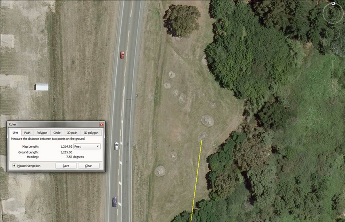
This outer-marker appears to have been intended to carry the lunar code of 1215-feet on an angle of 7.56-degrees.
The 1215 value is primarily part of a lunar progression which goes:
1215, 2430, 3645, 4860, 6075, 7290, 8505, 9720, ... 17010, ... 25515,... 68040, etc.
In the 6804-day lunar nutation cycle, there would be 121.5-days X 56. This cycle could have been conveniently counted on the Aubrey Circle at Stonehenge with its 56 post positions.
The coded 7.56-degree angle was in homage to the 756-feet length of the Great Pyramid and the navigational values it engendered..
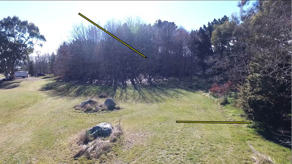
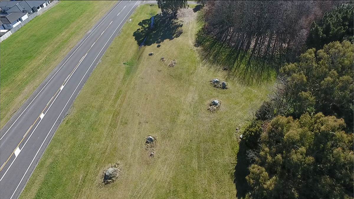
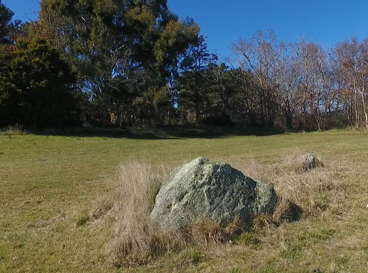
The foreground boulder is position 3 of site 2. Behind it are two boulders that have an uncanny resemblance to Mount Tongariro and Mount Ngauruhoe standing almost side by side, whereas Mount Ruapehu stands further to the south. From the very symmetrical, raised mound position in the deciduous trees to the rear (see arrow) the 3 volcanoes across Lake Taupo can be seen.
Another arrow to the right of the picture indicates the position of another obelisk hidden under the trees.
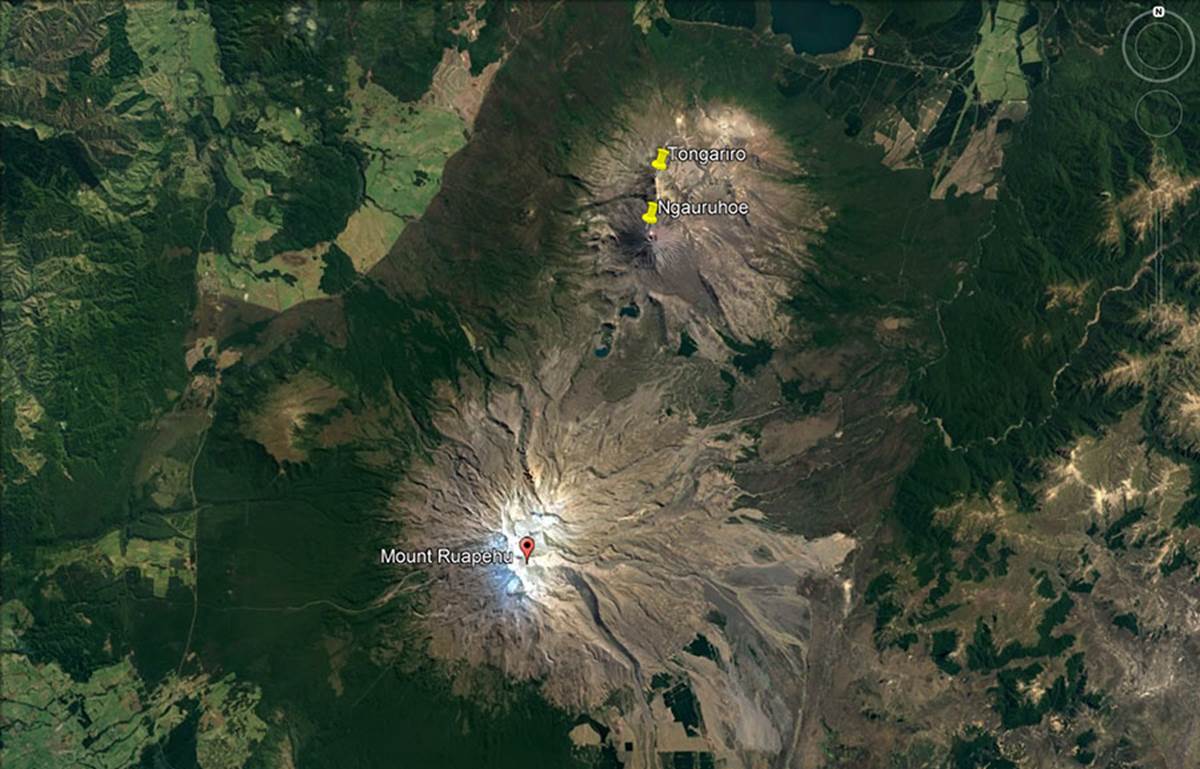
The volcanic cones of New Zealand’s Central Volcanic Plateau in the North Island.